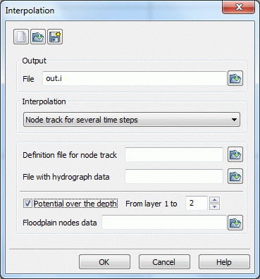
This algorithm can, for example, interpolate or rather extrapolate measured water levels in a receiving water course to all nodes of the mesh representing the stream. If the measured values involve pathlines, then the interpolation can work with several time steps. (A one-time interpolation of data on a continuous line can possibly be made easier in the SPRING-surface.) This is useful for time-dependent measured values. For instance, it is possible to create a transient input file which models a high-water wave (flood crest) in a river.

The procedure requires two additional files:

The first one contains a list of the nodes along the polygonal line, e. g. the receiving water course (format of the model file).

The second file contains the measured values (single values or time-dependent) in the format of nominal time-dependent lines. The first and the last measuring point can be outside of the modelling area. In that case, the user defines the distance.
Attention: The interpolation considers only the time steps of the pathline in the data file. All data of other time steps are not considered for the interpolation! Furthermore, note that if the value of a point on a pathline is not defined at one of these time points, then this value is never completed with the help of another time-step!
To avoid misunderstandings, please keep the following points in mind:

The time steps, on which time-dependent data are defined, should be the same for all nodes lying on the nodal line.

If there are missing values in some time-dependent lines, at some time steps you should insert convenient values before the interpolation!
Potential over the depth
Furthermore, the interpolated transient boundary conditions can be assigned to the topmost layer of a 3D model as well as to the layers below.
This is done by activating the check box Potential over the depth and selection of the deepest layer number.
Floodplain node data
As part of the interpolation a transient input file with "floodplain nodes" is additionally created. The file contains a node number per line. Their boundary condition is determined by a projection to the nodal line. If the computed potential head is lower than the ground level (), then the program automatically switches off the boundary condition of the corresponding node (output with a negative node number).
The consideration of the foreland is often required for large receiving water courses in order to define the impact of a flood wave on the foreland, eg to define flood areas.
The procedure is described in detail in the following chapter.

 Realization in SPRING