Description of the study area
SPRING-help >> Structure of the individual model types >> Construction of a 2D-Model >> Step 2: Generation of an FE mesh having irregular constraint geometries >>
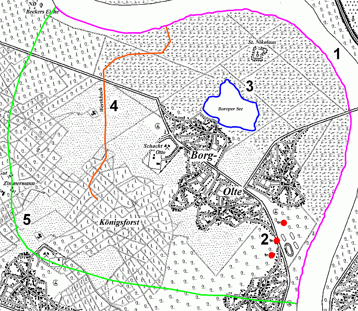
The study area of the model to be created is as follows:
Study area
The georeferenced Tiff file "topo1.zip" and all other required files can be found in the zip file of the tutorial that can be downloaded from our homepage.
The study area can be described as follows:
A large main watercourse (pink) extends from the south-east to the north-west, into which a smaller stream (orange) flows. There is also a lake (blue) with groundwater contact in the study area. There are also three groundwater extraction wells (red) in the south-east. As these constraints have an influence on the local groundwater situation, they must be taken into account in the model area.
 Questions for a groundwater model
Stand: 06.05.2025 | 