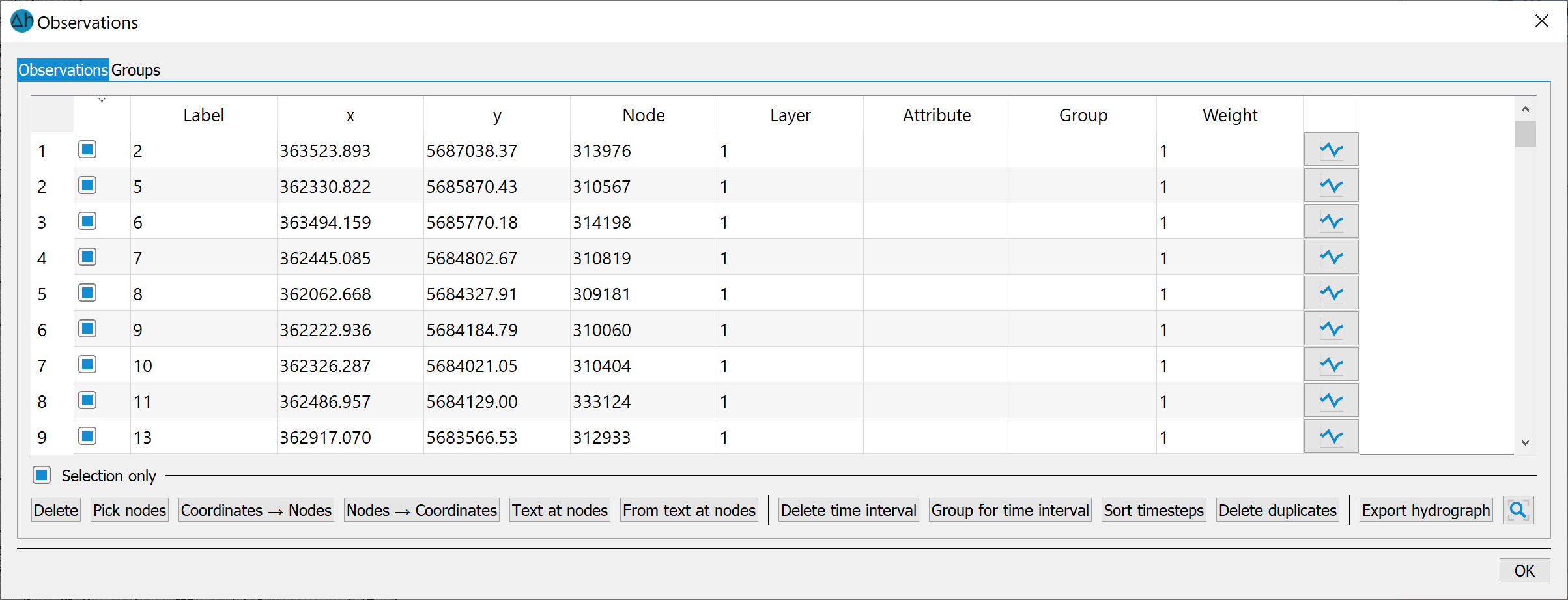
As soon as data has been imported, this menu item is active and the following input window appears:
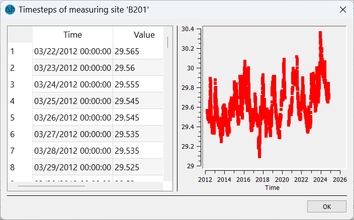
The symbol 
 can be used to display the respective hydrograph data:
Selection only
If this check box is activated, the user must explicitly select the rows for which he wants to perform an action. In addition, each individual line can be activated or deactivated.
Delete
All or individual observation points (depending on the selection) can be deleted.
Pick nodes
The button can be used to manually assign n observation point to a model node:
After selecting a node field in the table, the desired model node can be interactively snapped in the open model.
Coordinates
 Nodes
Nodes
After selecting this function, the observation points are assigned to the nearest model nodes via their coordinates. An input window appears in which a snap radius is determined: This is the maximum distance between a model node and the observation point.
Nodes
Coordinates
If a target file has been imported, this function can be used to assign the coordinates of the model nodes to the corresponding observation point.
Text at nodes
Der Messstellenname wird dem zugehörigen Modellknoten zugewiesen (Datenart KTXT).
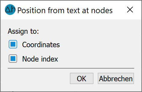
From text at nodes
If hydrograph data or a target file has been imported whose observation point names are already stored as node texts in the model file, the corresponding node numbers and thus also the coordinates can be assigned via this function.
Delete time interval
Time steps can be deleted within an interval.
Group for time interval
It is possible to assign a time interval to a specific group of observation points.
Sort timesteps
Since the observation data in the target file must always be sorted by ascending date, the imported data can be corrected with this function if necessary.
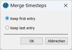
Delete duplicates
Logger data often provide hourly values, which are not desired when creating a target file. This function can be used to delete duplicate values. There is a choice of whether the first or last value should remain:
Export hydrograph
Each observation point can be exported as a single hydrograph.
If both the master and the hydrograph data are processed and assigned with sufficient accuracy, the edit menu is closed. The observation data can then be saved in an *.obs file and the target file can be exported via the corresponding menu item. The following menu appears:
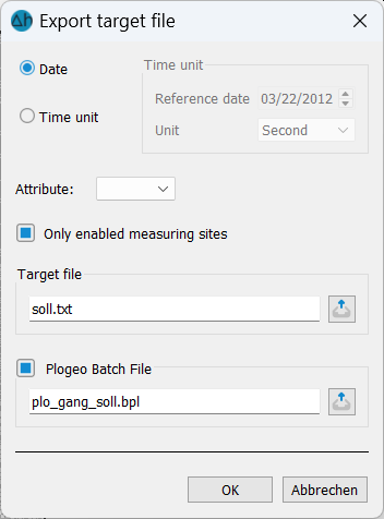
In addition to the target file, a *.bpl file with the node numbers of the hydrographs is also prepared for later plotting.
Stand: 22.05.2026 | 