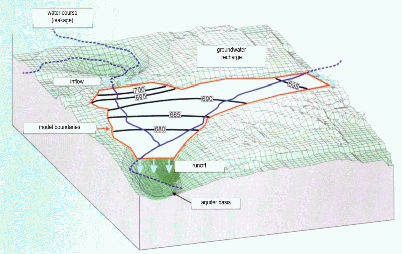
From nature to the model
A groundwater model should be able to simulate natural hydrogeological conditions. To this end, raw data such as groundwater observation points and water level measurements, geological and topographical maps, and other water management documents must first be collected, and a research question must be formulated. The development of a conceptual model follows by selecting which aquifers to include and the appropriate model boundaries. Once completed, the creation of the groundwater model in SPRING can begin.
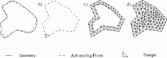
Discretisation of a conceptualised area
All raw data is read into SPRING by means of data import or digitisation and saved as structures. The structures are mesh-independent. The data can be visualised and subjected to an initial check before mesh generation.
A systematic model structure with SPRING can be schematised as follows:
Data becomes structures,
mesh-relevant structures become contours,
Contours become nodes,
Nodes become elements.
Attributes are assigned to the nodes and elements of the created finite element (FE) mesh.
 Structures
Stand: 29.10.2025 | 