The bitmap menu can be selected both in Model file mode and in Plot file mode. It is identical in both modes. The following menu items are available:
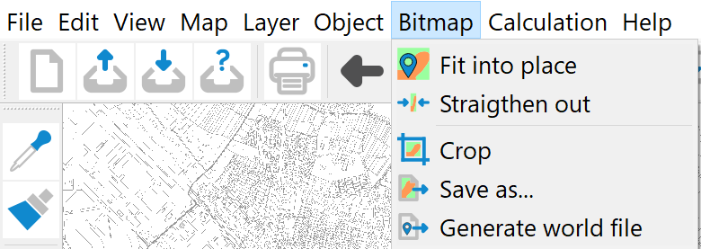
Fit into place, Straighten out
The Fit into place and Straighten out functions are used to provide a raster with the corresponding coordinate information in order to enable precise overlaying with other representations. The raster is georeferenced. If the scale is not listed in the original TIFF file, SPRING assumes a scale of 1:10,000 when reading in such a file.
Using the menu item Map  Edit Adjust scale…, the actual scale of the TIFF file must first be specified. If this is not known, it is possible to calculate the length of a known distance on the map at a scale of 1:10,000 using the menu item View → Measure distance/angle. If the calculated and actual lengths do not match, the actual scale can be derived from the difference between the two values.
Once the scale of the TIFF file has been determined, a point whose coordinates are known must be marked with the left mouse button after calling up the Fit into place function. The following input window appears in which the actual coordinates must be entered:
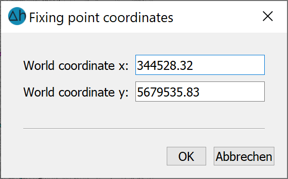
If the grid is then to be rectified, it is favourable if the point selected for fitting is as close as possible to the bottom left corner of the image.
To compensate for any distortions of the fitted grid, a second point with its real coordinates can be entered using the Straighten out menu item. This second point should be as close as possible to the top right-hand corner of the image. The straightening out is carried out linearly via the two control points and is therefore not suitable for compensating for complicated distortions of the template.
If a TIFF file is imported for which a *.tfw file already exists (in the same directory), the raster can be omitted.
The file names of the ".tif" and the ".tfw" file must be identical (except for the file extension)!
Crop
The Crop menu item allows you to crop a rectangular area from all the imported rasters. This is useful if only part of the image is required as a base for the display. A rectangular window is opened with the left mouse button and all areas outside of this window are removed from the imported rasters when the left mouse button is released. The clipped raster (*.tif and *.tfw) is automatically saved in the working directory. The suffix “_clip” is appended to the original file name.
Save as…
Save as... saves the current status of the raster including the changes made up to that point. If several rasters are loaded, they must be saved separately. To do this, identify the raster to be saved with the left mouse button. A file selection window appears in which the name of the TIFF file can be entered.
Black and white TIFF files are saved in CCITT FAX 4 compression, colour TIFF files in PACKBITS compression.
Generate world file
This menu item is used to save a *.tfw file containing the generated "fitting information". If several rasters are loaded, these must be saved separately. To do this, identify the raster to be saved with the left mouse button.
The name of the *tfw file is automatically formed from the name of the raster file.
Stand: 22.05.2026 | 