After selecting the tab Measured data appears the following input block:
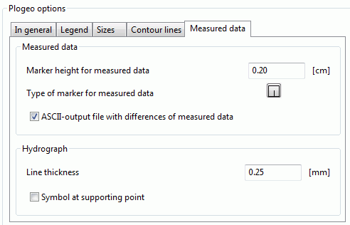
Marker height for measured data
The marker height [in cm] for the presentation of measurement data is set.
Type of marker for measured data
The marker type (plogeo.ini-command ETYP) for the presentation of measurement data is set. After clicking on the marker the following table appears with all possible marker types:
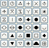
The corresponding marker number is then assigned to the plogeo.ini command ETYP . Default is the marker type 3 (cross). For the first marker of the table is ETYP = 0, then the markers are numbered line by line.
ASCII-output file with differences of measured data
By activating this check box the plogeo.ini command EDIF is set to the value "1", that means, an ASCII file is created. Depending on the plot type there are two possibilities:

Computing the differences to measured data
The computed differences between calculation results and measured data (EICH) are written to the ASCII file DiffEich.txt/csv using the format for characteristic data (6X, F10.2, F10.2, F10.2). The data are X-coordinate, Y-coordinate, difference, measured value, calculated value.
Plotting a hydrograph with nominal values
In this case, an ASCII file called C<node/element number>.csv is created for each node or element. Available are the following data:
Calculated value, measured value, time, node/element number (format F10.2, 1X, F10.2, 1X, F10.2, 1X, I10)
Both ASCII files can be used for creating so-called scatter plots (comparison of calculated and measured values in an x/y-diagram).
If other than the described plots are created, or the check box is disabled (EDIF = 0), no ASCII file is created.
Hydrographs
The line width for the presentation of hydrograph curves is set (plogeo.ini command GSTR). By activating the checkbox symbols at supporting points are set (plogeo.ini command GMARK).
 Objects