
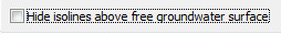
Hide isolines above free groundwater surface
Contour lines can be hidden in a vertical cross section or vertical model above the free surface.
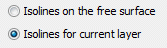
Contour lines for potential heads in a 3D model
When representing contour lines of the potential heads in a 3D model it is is not necessarily known, for which horizontal layer the potential heads lie in the saturated zone.
Independent of that, in a horizontal section of a 3D model the potential heads can be represented at the free surface (first from above if there are more than one).
Presentation with a digital altitude model
Is a digital altitude model available the contour lines of the ground level (model data) and the distances between ground and water level (result data) can be plotted on the basis of the digital altitude model. The altitude model must have the structure format (ASCII).
When plotting the ground level instead of the attribute GELA the digital altitude model is plotted.
For the presentation of the distances between ground and water level (attribute FLUR) they are determined by offsetting the altitude model against the calculated potential heads. In both cases, an auxiliary mesh based on the altitude model and the FE nodes is created, so that the generation of such a plot takes some time, depending on the size of the data records and the available computing power.
It is possible to present the resulting auxiliary mesh (checking the box Plot mesh):
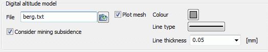
When terrain settings are present in the model file (attribute BERG), it is possible, to lower the digital altitude model with the subsidences of the model.
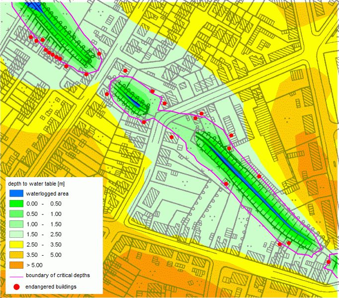
The advantage of calculation the distance between ground and water level based on the altitude model can be illustrated by the following example:
The presented water course (attributes VORF and LERA) is a water whose water bed should be raised within a regeneration. In the area of influence of the water course a rise of groundwater is expected. To preserve evidence therefore an assessment of the situation of the distance between the ground and water level is carried out for the current state (state of the model file).
Built-up areas are regarded as critical, which distance between ground and water level is already below 1.5 m in the current state.
To illustrate the improved accuracy obtained by calculating the distance between ground and water level with the altitude model, a plot of the distances was created after the flow calculation with and without use of the digital altitude model.
Result without using the digital altitude model (26 buildings are affected)
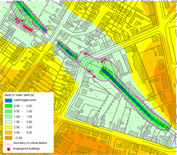
Result with using the digital altitude model (13 buildings are affected)
On the basis of the digital altitude model only half of the buildings is classified as critical.
The enormous difference in accuracy is due to the by a multiple higher grid density of the altitude model (here: 5 x 5 m - grid) compared with the density of the FE mesh nodes whose approximate distance in this model is about 30-50 meters.
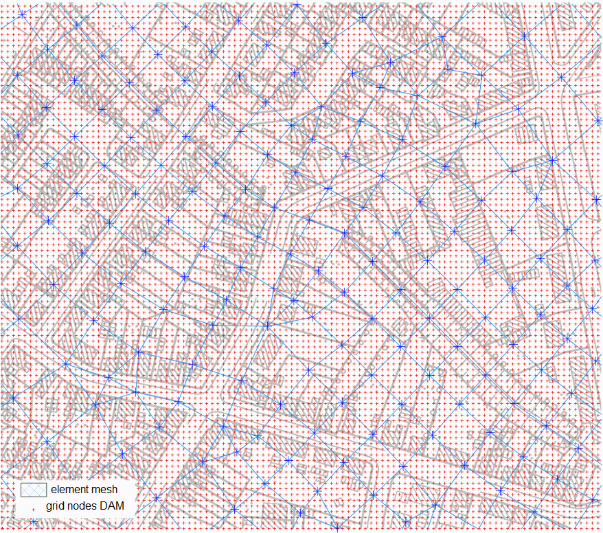
Comparing the density of the mesh nodes (blue) to the density of the grid nodes of the altutude model (red)
 Flat
Flat