Attribute: BERG [m] (horizontal or 3D models only)
These values represent the influence of terrain settings caused by subsurface mining on lower and upper boundaries, the aquifer thickness, receiving water course and ground levels. A consideration of these data types is done automatically. Therefore, when entering these values, the altitudes based on the reference time of the subsidences have to be entered. In regions where no settings occur, you must assign the value 0.0 to each node (unit is m).
By subsidences especially the overground proportions of the receiving water are affected. Thus, an exfiltrating water course (receiving water) can cut deeper in the aquifer, by which an increased groundwater discharge results.
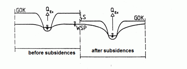
Influence of terrain settings on an exfiltrating water
On the other hand, the subsidences cause that the previously exfiltrating water course loses his gap and no longer drains its surrounding. Result, it caused water logging at the surface.
For a before infiltrating water, it is possible that the subsidences cause an incision into the aquifer and the infiltration process is reversed in an exfiltrations process.
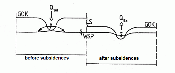
Influence of terrain settings on an infiltrating water