To consider geological faults or local limited aquitards in a 3D model a vertical mesh refinement is requested. By using the function Mesh  3D
3D  Divide layer in SPRING you can refine the mesh in the vertical direction. The attributes for the new elements and nodes are automatically generated (equivalent to the horizontal mesh refinement).
Only with the help of the exact z-coordinates can partial layers, which do not run through the entire three-dimensional model, be possible. To create the end of a layer, the z-coordinate of the lower node layer must be equal to that of the upper layer, for all nodes along the layer boundary. Afterwards, the model checking eliminates the superfluous nodes and elements. Then, the calculation modules will manage only the absolutely necessary data.
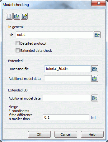
A parameter in the input window of the model checking decides wether the z-coordinates are merged or not. A value of 0.01 m is set, that means, if the vertical spacing of two nodes is lower or equal 1 cm the nodes are merged to one node.

Model checking with 3D extension
