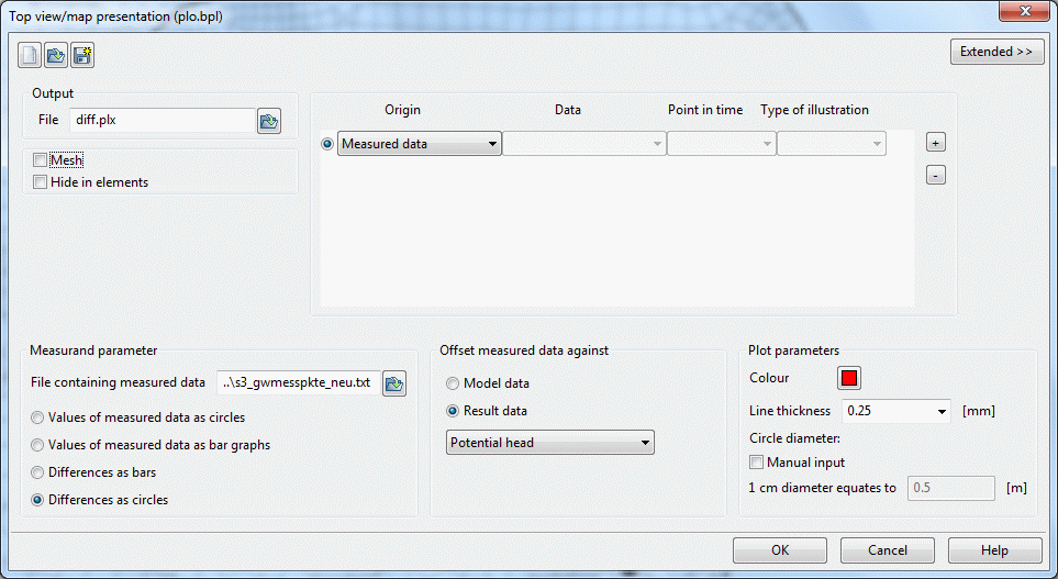
When a measured data file is available, the differences between measured and calculated groundwater levels can be displayed at the measuring points (usually groundwater measuring points) by "Differences as circles".
This is done during the plot display by selecting "Measured data" under data origin. An input window appears in which the file containing the measured values and the data to be used for calculation are defined:
Generating a difference plot
The file containing the measured data was already made available for download in Step 3: Data assignment.
In the input window, differences are selected as circles, giving the following picture:
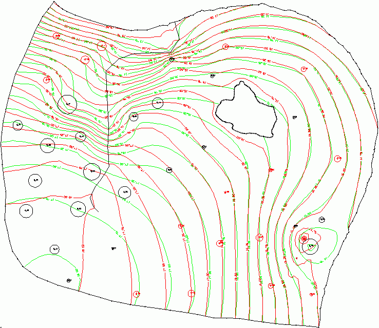
Contour lines with measured differences
The calculated isolines already reflect relatively closely the curve of the isolines determined by measurement, in particular in the eastern part. The deviation at the measuring points is at most 0.47 m, being on average 0.10 m. (These deviations are displayed in the protocol window of the plot display. The deviations in the calibration protocol window refer to all nodes and are at most 1.24 m, on average 0.11 m). The calculated differences are shown for each measuring point:
Positive values (black) mean: The model calculation produces larger values than the measurement. In this example, that means: In the model, there is too much water at this position. Negative values (red) mean that the calculation produces smaller values than the measurement. In this case, that means: In the model, there is too little water at this position.
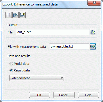
Note: If the calculated differences are to be saved as a file for later evaluation, this can be done under File  Export Difference to measured data:
Export of differences of measured data
The next step is Calibration in 3 steps